Archaeology at Vrahos

The Site

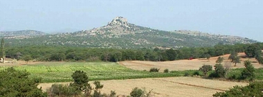
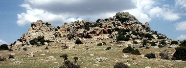
Vrahos is a craggy, tower-like mass of volcanic rock crowning a conical hill in the north-central part of the Petrota graben (Fig. 1). Its main exposed part is 170 m long, up to 55 m wide, and rises c. 20 m above the apex of the hill, to 221 m asl (Fig. 2). The rock is a silicified (hydrothermally altered) dacitoid andesite and is characterized in general by conchoidal fracture. The same silicified rock—we call it “Vrahos silex”—constitutes the bedrock in much of the hill. Adjacent geological units on all sides consist of andesitic rocks of coarser textures and lower cohesion. In contrast with the Vrahos silex, the latter rocks are much weathered and, in hand specimen, they are often friable.

The slopes of the hill below the tower-like feature are littered with prodigious quantities of Vrahos silex gravel, including readily recognizable prehistoric tools, blanks and cores. This silex scatter covers c. 1 sq. km (Fig. 3). Its boundary is in general distinct and it largely coincides, on the one hand, with the boundary of the silicified dacitoid andesite (Vrahos silex) unit and, on the other hand, with the foot of the hill. This suggests that the configuration of the scatter today is controlled by geomorphological factors, that is, slope gradients, erosion, and the different rates of weathering of the local bedrock. It is therefore a poor guide to the spatial extent of human activities in the past.

The density of the lithic scatter varies dramatically across the surface of the hill. It can exceed 100 pieces per sq. m but it can also be as low or lower than one piece per 100 sq. m. This variation is principally caused by two closely interrelated factors, erosion and ground visibility, as we were able to determine through systematic sampling (total collection of surface gravel) and statistical treatment of the samples (Fig. 4). Once again, that is, density is controlled by present (and ephemeral) conditions, and says little about human activities in the past.

In short, in more than 99% of the hill’s slopes, gravel is in the long term downward mobile. Spots of high density are areas where gravel is temporarily trapped. When erosion changes the local micro-topography, gravel may migrate downward, density will change, and new concentrations will form. Areas protected from long term erosion and thus exempt from this rule are few and small.
Highslide JS
Fig. 1: The hill of Vrahos (view from SE).

figure 1

Highslide JS
Fig. 2: Vrahos (view from SW).

figure 2

Highslide JS
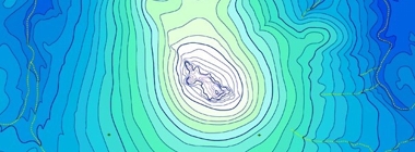
Fig. 3: Contour map of the Vrahos hill. North is up. Scale is in meters. Contour lines at are at 4 m intervals. Highest point (near center) is 221 m asl. Red hues (b) indicate the area occupied by the silex scatter. Note the small area appearing as a separate, isolated scatter, far right. In the initial stages of fieldwork, before we became acquainted with the local geomorphology, we thought this could be a distinct archaeological site (area of prehistoric human activity). In fact, this and other discontinuities in the distribution of surface silex gravel are effects of the local geomorphology.

figure 3

Highslide JS
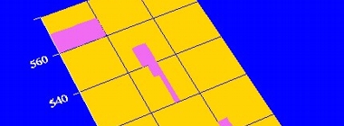
Fig. 4: We began our research in 1998 by systematically sampling a small part (60x100 m) of the silex scatter (a, yellow rectangle). We collected all loose silex from 108 sampling units, arranged in four blocks (b, purple areas) and covering in total 480 sq. m. We counted and weighed the silex pieces from each sampling unit, we divided them in classes according to size, and plotted the results in several ways. Examples of the plots are shown in c and d. Combined with data on ground conditions and gradients for each sample, these statistics helped us identify the chief cause of the variation in the density of the scatter. We found that such variation (illustrated in c) was due above all to the synergy of two factors operating in the present, namely, erosion and ground visibility. It could not, therefore, be but a remote, indirect reflection of the distribution of prehistoric human activities at the site. The 108 samples we took in 1998 contained thousands of silex pieces and weighed together 185 kilograms. Only a handful of these pieces, however, appeared to have derived from reduction sequences geared to tool manufacture. In subsequent years we took many more "total collection" samples, and from different areas of the hill. The result in nearly every case was the same: the vast majority of silex pieces were angular fragments that could have been generated through a variety of natural processes and human activities.

figure 4


Warning: Unknown(): open(/var/lib/php/sess_70af6247ad04522f6595b3a8e5aa19f4, O_RDWR) failed: No space left on device (28) in Unknown on line 0

Warning: Unknown(): Failed to write session data (files). Please verify that the current setting of session.save_path is correct (/var/lib/php) in Unknown on line 0